|
Open Inventor Release 2026.1.0
|
|

| |
|
Open Inventor Release 2026.1.0
|
|
|
| |
 Specifies a uniform grid of elevation values within some spatial reference frame.
More...
Specifies a uniform grid of elevation values within some spatial reference frame.
More...
#include <Inventor/geo/SoGeoElevationGrid.h>
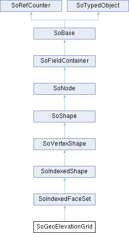
 Inheritance diagram for SoGeoElevationGrid:
Public Member Functions | |
| virtual SoType | getTypeId () const |
| Returns the type identifier for this specific instance. | |
| SoGeoElevationGrid () | |
| Constructor. | |
| Public Member Functions inherited from SoIndexedFaceSet | |
| SoIndexedFaceSet () | |
| Creates an indexed face set node with default settings. | |
| Public Member Functions inherited from SoVertexShape | |
| SoNormalCache * | getNormalCache () const |
| Returns the current normal cache, or NULL if there is none. | |
| SoTangentCache * | getTangentCache () const |
| Returns the current tangent cache, or NULL if there is none. | |
| Public Member Functions inherited from SoShape | |
| virtual SbBool | affectsState () const |
| Overrides default method on SoNode. | |
| ShapeType | getShapeType () |
| Gets the current shape Full Scene Antialiasing type. | |
| Public Member Functions inherited from SoNode | |
| virtual void | setOverride (const SbBool state) |
| Turns the override flag on or off. | |
| virtual SbBool | isOverride () const |
| Returns the state of the override flag. | |
| virtual SoNode * | copy (SbBool copyConnections=FALSE) const |
| Creates and returns an exact copy of the node. | |
| virtual void | touch () |
| Marks an instance as modified, simulating a change to it. | |
| Public Member Functions inherited from SoFieldContainer | |
| void | setToDefaults () |
| Sets all fields in this object to their default values. | |
| SbBool | hasDefaultValues () const |
| Returns TRUE if all of the object's fields have their default values. | |
| SbBool | fieldsAreEqual (const SoFieldContainer *fc) const |
| Returns TRUE if this object's fields are exactly equal to fc's fields. | |
| void | copyFieldValues (const SoFieldContainer *fc, SbBool copyConnections=FALSE) |
| Copies the contents of fc's fields into this object's fields. | |
| SoNONUNICODE SbBool | set (const char *fieldDataString) |
| Sets one or more fields in this object to the values specified in the given string, which should be a string in the Open Inventor file format. | |
| SbBool | set (const SbString &fieldDataString) |
| Sets one or more fields in this object to the values specified in the given string, which should be a string in the Open Inventor file format. | |
| void | get (SbString &fieldDataString) |
| Returns the values of the fields of this object in the Open Inventor ASCII file format in the given string. | |
| virtual int | getFields (SoFieldList &list) const |
| Appends references to all of this object's fields to resultList, and returns the number of fields appended. | |
| virtual int | getAllFields (SoFieldList &list) const |
| Returns a list of fields, including the eventIn's and eventOut's. | |
| virtual SoField * | getField (const SbName &fieldName) const |
| Returns a the field of this object whose name is fieldName. | |
| virtual SoField * | getEventIn (const SbName &fieldName) const |
| Returns a the eventIn with the given name. | |
| virtual SoField * | getEventOut (const SbName &fieldName) const |
| Returns the eventOut with the given name. | |
| SbBool | getFieldName (const SoField *field, SbName &fieldName) const |
| Returns the name of the given field in the fieldName argument. | |
| SbBool | enableNotify (SbBool flag) |
| Notification at this Field Container is enabled (if flag == TRUE) or disabled (if flag == FALSE). | |
| SbBool | isNotifyEnabled () const |
| Notification is the process of telling interested objects that this object has changed. | |
| virtual void | setUserData (void *data) |
| Sets application data. | |
| void * | getUserData (void) const |
| Gets user application data. | |
| Public Member Functions inherited from SoBase | |
| virtual SbName | getName () const |
| Returns the name of an instance. | |
| virtual void | setName (const SbName &name) |
| Sets the name of an instance. | |
| void | setSynchronizable (const bool b) |
| Sets this to be a ScaleViz synchronizable object. | |
| bool | isSynchronizable () const |
| Gets the ScaleViz synchronizable state of this object. | |
| Public Member Functions inherited from SoRefCounter | |
| void | ref () const |
| Adds a reference to an instance. | |
| void | unref () const |
| Removes a reference from an instance. | |
| void | unrefNoDelete () const |
| unrefNoDelete() should be called when it is desired to decrement the reference count, but not delete the instance if this brings the reference count to zero. | |
| int | getRefCount () const |
| Returns current reference count. | |
| void | lock () const |
| lock this instance. | |
| void | unlock () const |
| unlock this instance. | |
| Public Member Functions inherited from SoTypedObject | |
| SbBool | isOfType (const SoType &type) const |
| Returns TRUE if this object is of the type specified in type or is derived from that type. | |
| template<typename TypedObjectClass> | |
| SbBool | isOfType () const |
| Returns TRUE if this object is of the type of class TypedObjectClass or is derived from that class. | |
Static Public Member Functions | |
| static SoType | getClassTypeId () |
| Returns the type identifier for this class. | |
| Static Public Member Functions inherited from SoIndexedFaceSet | |
| static SoType | getClassTypeId () |
| Returns the type identifier for this class. | |
| Static Public Member Functions inherited from SoIndexedShape | |
| static SoType | getClassTypeId () |
| Returns the type identifier for this class. | |
| Static Public Member Functions inherited from SoVertexShape | |
| static SoType | getClassTypeId () |
| Returns the type identifier for this class. | |
| Static Public Member Functions inherited from SoShape | |
| static SoType | getClassTypeId () |
| Returns the type identifier for this class. | |
| static SbBool | isPrimitiveRestartAvailable (SoState *state=NULL) |
| Returns TRUE if the primitive restart feature is available. | |
| Static Public Member Functions inherited from SoNode | |
| static SoType | getClassTypeId () |
| Returns the type identifier for this class. | |
| static SoNode * | getByName (const SbName &name) |
| A node's name can be set using SoBase::setName(). | |
| static int | getByName (const SbName &name, SoNodeList &list) |
| A node's name can be set using SoBase::setName(). | |
| Static Public Member Functions inherited from SoFieldContainer | |
| static SoType | getClassTypeId () |
| Returns the type of this class. | |
| Static Public Member Functions inherited from SoBase | |
| static SoType | getClassTypeId () |
| Returns type identifier for this class. | |
| Static Public Member Functions inherited from SoTypedObject | |
| static SoType | getClassTypeId () |
| Returns the type identifier for this class. | |
Public Attributes | |
| SoSFFloat | yScale |
| The yScale value can be used to produce a vertical exaggeration of the data when it is displayed. | |
| SoSFVec3f | geoGridOrigin |
| Specifies the geographic coordinate for the south-west corner (bottom-left) of the dataset. | |
| SoMFString | geoSystem |
| Defines the spatial reference frame. | |
| SoMFFloat | height |
| The height array contains xDimension * zDimension floating point values that represent elevation above the ellipsoid or the geoid, as appropriate. | |
| SoSFInt32 | xDimension |
| Number of X values in the grid. | |
| SoSFFloat | xSpacing |
| Spacing between X values. | |
| SoSFInt32 | zDimension |
| Number of Z values in the grid. | |
| SoSFFloat | zSpacing |
| Spacing between Z values. | |
| Public Attributes inherited from SoIndexedShape | |
| SoMFInt32 | coordIndex |
| The indices of the coordinates that the shape uses as its vertices. | |
| SoMFInt32 | materialIndex |
| The indices of the materials that are used for the shape. | |
| SoMFInt32 | normalIndex |
| The indices of the normals that are used for the shape. | |
| SoMFInt32 | tangentIndex |
| The indices of the tangents that are used for the shape. | |
| SoMFInt32 | textureCoordIndex |
| The indices of the texture coordinates that are used for the shape. | |
| Public Attributes inherited from SoVertexShape | |
| SoSFNode | vertexProperty |
| vertex property node. | |
| Public Attributes inherited from SoShape | |
| SoSFBool | boundingBoxIgnoring |
| Whether to ignore this node during bounding box traversal. | |
Additional Inherited Members | |
| Public Types inherited from SoShape | |
| enum | ShapeType { POINTS , LINES , POLYGONS , TEXT } |
| Basic type for antialiased rendering for this shape (Do not consider the SoDrawStyle property currently in the state). More... | |
Specifies a uniform grid of elevation values within some spatial reference frame.
The SoGeoElevationGrid allows to create terrain models for local or large areas (automatically introduces correct degree of earth curvature).
The SoGeoElevationGrid node specifies a uniform grid of elevation values within some spatial reference frame. These are then transparently transformed into a geocentric, curved-earth representation. For example, this would allow a geographer to create a height field where all coordinates are specified in terms of latitude, longitude, and elevation. The geoSystem field is used to define the spatial reference frame and is described in 25.2.3 Specifying a spatial reference frame. The geoGridOrigin field specifies the geographic coordinate for the south-west corner (bottom-left) of the dataset. This value should be specified as described in 25.2.4 Specifying geospatial coordinates. The height array contains xDimension zDimension floating point values that represent elevation above the ellipsoid or the geoid, as appropriate. These values are given in row-major order from west to east, south to north. When the geoSystem is "GD", xSpacing refers to the number of degrees of longitude between adjacent height values and zSpacing refers to the number of degrees of latitude between vertical height values. When the geoSystem is "UTM", xSpacing refers to the number of eastings (meters) between adjacent height values and zSpacing refers to the number of northings (meters) between vertical height values. EXAMPLE If xDimension = n and the grid spans d units horizontally, the xSpacing value should be set to: d / (n-1). The yScale value can be used to produce a vertical exaggeration of the data when it is displayed. By default, this value is 1.0 (no exaggeration). If this value is set greater than 1.0, all heights will appear larger than actual.
| yScale | 1.0 |
| geoGridOrigin | 0 0 0 |
| geoSystem | ["GD","WE"] |
| height | [] |
| xDimension | 0 |
| xSpacing | 1.0 |
| zDimension | 0 |
| zSpacing | 1.0 |
Definition at line 93 of file SoGeoElevationGrid.h.
| SoGeoElevationGrid::SoGeoElevationGrid | ( | ) |
Constructor.
|
static |
Returns the type identifier for this class.
|
virtual |
Returns the type identifier for this specific instance.
Reimplemented from SoIndexedFaceSet.
| SoSFVec3f SoGeoElevationGrid::geoGridOrigin |
Specifies the geographic coordinate for the south-west corner (bottom-left) of the dataset.
Definition at line 112 of file SoGeoElevationGrid.h.
| SoMFString SoGeoElevationGrid::geoSystem |
Defines the spatial reference frame.
Valid values are:
Definition at line 128 of file SoGeoElevationGrid.h.
| SoMFFloat SoGeoElevationGrid::height |
The height array contains xDimension * zDimension floating point values that represent elevation above the ellipsoid or the geoid, as appropriate.
These values are given in row-major order from west to east, south to north.
Definition at line 135 of file SoGeoElevationGrid.h.
| SoSFInt32 SoGeoElevationGrid::xDimension |
Number of X values in the grid.
Definition at line 140 of file SoGeoElevationGrid.h.
| SoSFFloat SoGeoElevationGrid::xSpacing |
Spacing between X values.
When the geoSystem is "GD", xSpacing refers to the number of degrees of longitude between adjacent height values. When the geoSystem is "UTM", xSpacing refers to the number of eastings (meters) between adjacent height values.
Definition at line 148 of file SoGeoElevationGrid.h.
| SoSFFloat SoGeoElevationGrid::yScale |
The yScale value can be used to produce a vertical exaggeration of the data when it is displayed.
By default, this value is 1.0 (no exaggeration). If this value is set greater than 1.0, all heights will appear larger than actual.
Definition at line 106 of file SoGeoElevationGrid.h.
| SoSFInt32 SoGeoElevationGrid::zDimension |
Number of Z values in the grid.
Definition at line 153 of file SoGeoElevationGrid.h.
| SoSFFloat SoGeoElevationGrid::zSpacing |
Spacing between Z values.
When the geoSystem is "GD", zSpacing refers to the number of degrees of latitude between vertical height values. When the geoSystem is "UTM", zSpacing refers to the number of northings (meters) between vertical height values.
Definition at line 162 of file SoGeoElevationGrid.h.